SeekrGeo
The world has more geospatial data than ever, yet we can’t extract intelligence fast enough. SeekrGeo is a geospatial reasoning assistant that synthesizes multimodal signals across sensors and time to deliver decision-ready intelligence for critical operations.
The first geospatial reasoning assistant for critical decisions
SeekrGeo accelerates decision-making across industries and use cases, including infrastructure monitoring, asset risk, supply chain visibility, insurance, and competitive intelligence. Rather than producing isolated detections, SeekrGeo synthesizes intelligence across sensors and time and reasons like an expert analyst.
Multimodal fusion
Understand the physics and signals behind optical imagery, SAR, hyperspectral data, and more.
Contextual intelligence
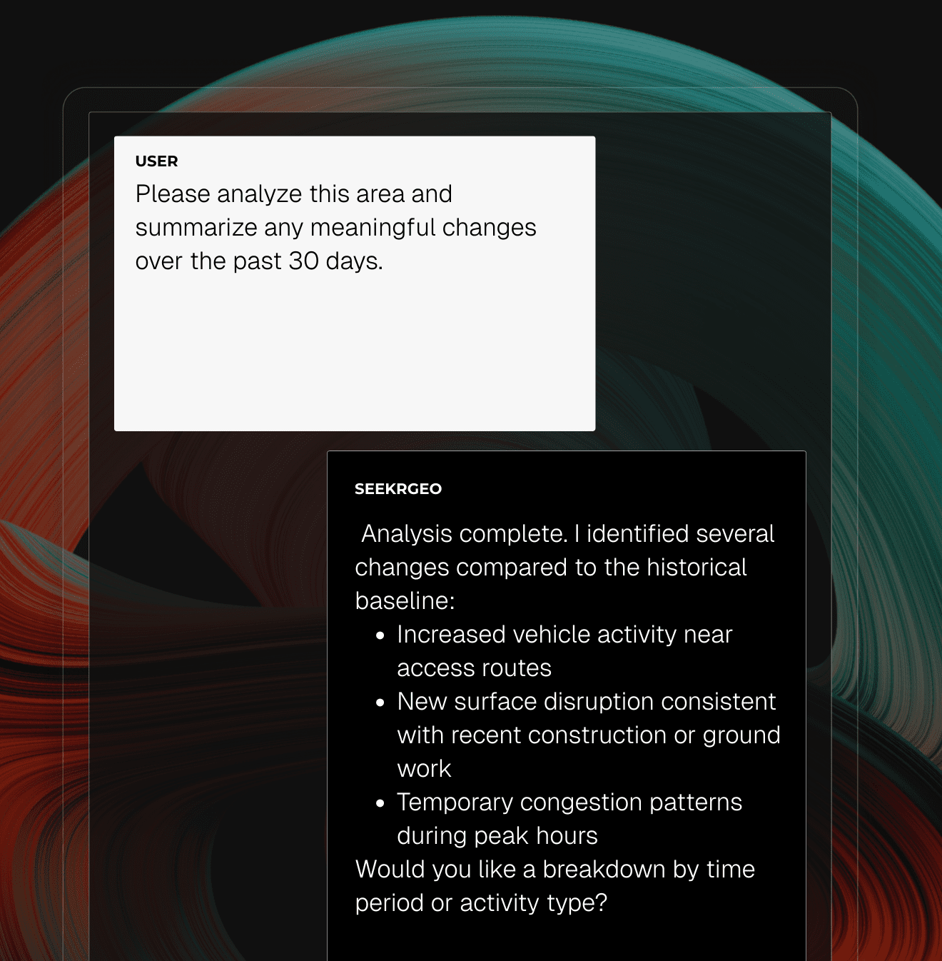
Receive analyst-level insights into why an object or change matters and what it indicates.
Temporal intelligence
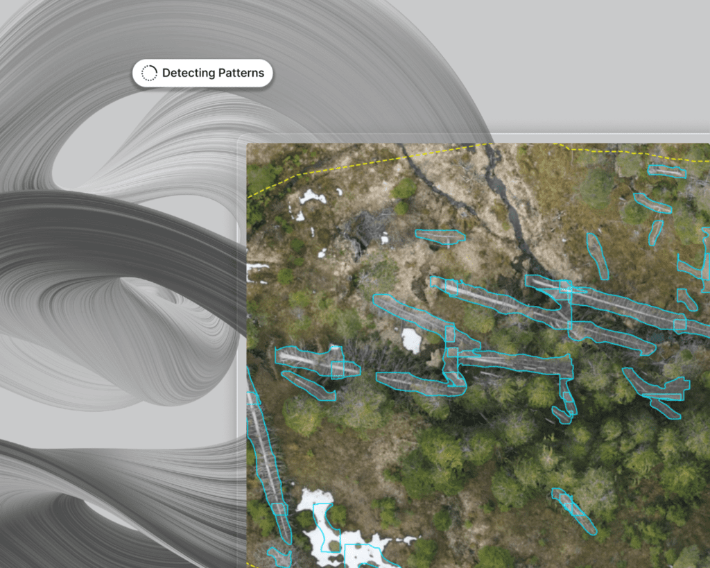
Detect meaningful change over time, build baselines, and identify patterns in activity, behavior, and operational tempo.
Natural language interaction
Query complex geospatial data using plain language for accessible insights, no PhD required.
Tool integration
Work alongside your existing object detection, segmentation, GIS, and data source tools.
Commercial remote sensing imagery is now widely accessible, delivering terabytes of multimodal data daily. However, there remains a lack of true geospatial intelligence. Most solutions stop at object detection and cannot reason across modalities or time, explain why insights matter, or interact naturally. SeekrGeo solves these challenges with a unified Remote Sensing Foundation Model built for multimodal understanding, contextual reasoning, and autonomous analysis.
Built for where trust matters most
Government
Support mission-critical decisions with explainable geospatial intelligence across infrastructure, security, and operational environments.
Support mission-critical decisions with explainable geospatial intelligence across infrastructure, security, and operational environments.
Industrial
Continuously detect, explain, and act on physical changes across distributed industrial assets to reduce risk and improve operational resilience.
Continuously detect, explain, and act on physical changes across distributed industrial assets to reduce risk and improve operational resilience.
Telecommunications
Monitor network infrastructure, detect physical risk, and anticipate service disruptions using geospatial intelligence across assets and environments.
Monitor network infrastructure, detect physical risk, and anticipate service disruptions using geospatial intelligence across assets and environments.
Supply Chain
Gain end-to-end visibility into assets, routes, and disruptions by turning geospatial data into decision-ready supply chain intelligence.
Gain end-to-end visibility into assets, routes, and disruptions by turning geospatial data into decision-ready supply chain intelligence.
Accelerate AI impact with SeekrFlow
Speed up and scale your AI development with data preparation, training, explainability, and orchestration in one operating system.
Learn more